GUATEMALA CITY – Volcanic activity at Guatemala’s Fuego volcano has begun to subside after an eruption earlier this week triggered large-scale evacuations, but authorities warned Wednesday that heavy rainfall could still generate dangerous lahars, leaving nearby communities at continued risk.
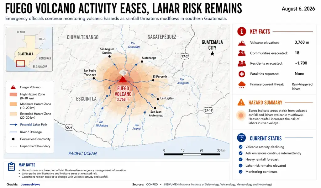
Guatemala’s National Coordinator for Disaster Reduction (CONRED) said eruptive activity has gradually declined since the volcano became more active on Monday. However, officials cautioned that a tropical wave approaching from the east could produce intense rainfall capable of triggering lahars—fast-moving mixtures of volcanic ash, mud, rocks and water that can rapidly travel down river valleys and cause widespread destruction.
Emergency officials urged residents to continue following evacuation orders and official safety instructions despite the reduction in volcanic activity.

Authorities Maintain Monitoring Despite Improving Conditions
CONRED said some residents evacuated between Monday and Tuesday have voluntarily returned to their homes, but emphasized that the volcano remains active and conditions can change quickly.
Authorities said continuous monitoring will remain in place as weather conditions evolve and emergency teams assess the risk of additional volcanic hazards.
More Than 1,700 Residents Were Evacuated
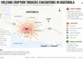
About 1,700 people from at least 18 communities surrounding Fuego were evacuated after the eruption began Monday.
Officials reported that no fatalities or significant property damage had been confirmed as of Wednesday.
Images from the area showed intermittent ash emissions throughout the day. During the height of the eruption, lava fountains reached approximately 300 meters (984 feet), prompting authorities to declare red alerts, close a major highway and suspend classes in the departments of Escuintla, Chimaltenango and Sacatepéquez.
■ Related News

Rainfall Now Presents the Greatest Threat
Emergency officials said the primary hazard has shifted from eruptive activity to the possibility that heavy rain could remobilize accumulated volcanic ash and debris.
Lahars remain among the most dangerous secondary hazards following volcanic eruptions because they can rapidly sweep through valleys and river channels long after explosive activity has diminished.
Authorities said communities located downstream from the volcano should remain vigilant until weather conditions improve.
One of Central America’s Most Active Volcanoes
Fuego rises approximately 3,768 meters (12,360 feet) above sea level and is one of Central America’s most active stratovolcanoes.
Located about 53 kilometers (33 miles) southwest of Guatemala City, the volcano spans the departments of Escuintla, Chimaltenango and Sacatepéquez and experiences frequent eruptive episodes.
2018 Disaster Remains a Stark Reminder
The latest eruption has revived memories of Fuego’s catastrophic eruption on June 3, 2018, when fast-moving pyroclastic flows devastated nearby communities, killing hundreds of people and affecting an estimated 1.7 million residents.
Another period of heightened volcanic activity last year also prompted precautionary evacuations, highlighting the persistent risk faced by communities living on the volcano’s slopes.
Authorities said they will continue monitoring volcanic activity and weather conditions while urging residents to remain alert and follow official guidance until the risk from lahars and other volcanic hazards has fully subsided.
This report is based on reporting by The Associated Press.