Journos News - Breaking News, World News, Top Stories, Todays Headlines and Flash Reports
Monday, September 7, 2026
  • Login
  • Home
  • World
    • Africa
    • Americas
    • Asia
    • Europe
    • Middle East
    • Oceania
  • Politics
  • Business
  • Technology
  • Health
  • Science
  • Sports
  • Entertainment
  • Culture
No Result
View All Result
  • Home
  • World
    • Africa
    • Americas
    • Asia
    • Europe
    • Middle East
    • Oceania
  • Politics
  • Business
  • Technology
  • Health
  • Science
  • Sports
  • Entertainment
  • Culture
No Result
View All Result
Journos News - Breaking News, World News, Top Stories, Todays Headlines and Flash Reports
No Result
View All Result
Home Science Climate & Environment

NASA Tracks Three Pacific Hurricanes as El Niño Drives Active Storm Pattern

New satellite observations show Lowell, Karina and Marie active together amid heightened eastern-Pacific cyclone activity.

The Daily Desk by The Daily Desk
September 7, 2026
in Climate & Environment, Science
0
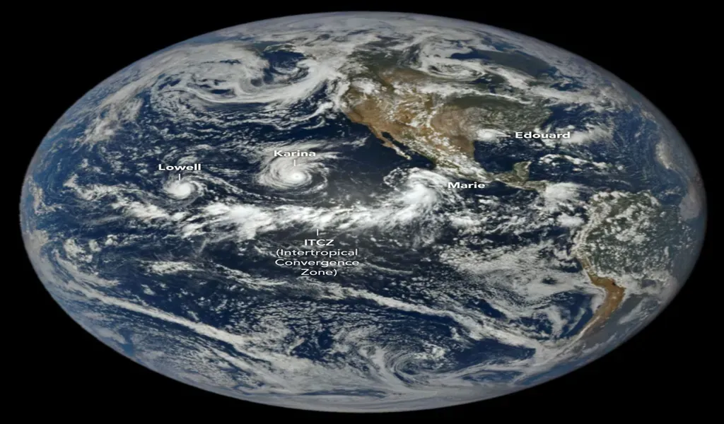
Satellite view of tropical cyclones Lowell, Karina and Marie swirling over the Pacific Ocean west of Central America.

NASA satellite imagery shows tropical cyclones Lowell, Karina and Marie over the Pacific Ocean on September 1, 2026.

NASA is tracking three hurricanes simultaneously across the Pacific, with new satellite observations showing Lowell, Karina and Marie active across the basin at the same time.

NASA’s Earth Observatory published imagery on Sept. 4 showing the three hurricanes spread across the Pacific, while NASA Earthdata released a separate satellite image from Sept. 2 capturing the systems simultaneously. The observations offer a broad view of an unusually concentrated period of tropical cyclone activity in the region.

The activity comes as eastern-Pacific ocean and atmospheric conditions favor tropical cyclone development, with NASA linking the heightened activity in part to the ongoing El Niño climate pattern.

Three Hurricanes Active Across the Pacific

Lowell, Karina and Marie developed in late August and early September, according to NASA Earthdata. The satellite imagery shows the three systems at different stages while occupying separate areas of the Pacific basin.

Seeing three organized tropical cyclones simultaneously across the same ocean basin provides a regional perspective that individual storm forecasts cannot always capture.

The systems are also spread across a large area, meaning the presence of three hurricanes does not by itself indicate that all three pose an immediate threat to populated areas.

El Niño Creates Favorable Conditions

NASA has linked heightened eastern-Pacific tropical activity to El Niño conditions.

El Niño warms portions of the equatorial Pacific and changes atmospheric circulation, creating conditions that can support tropical cyclone development in the eastern and central Pacific. Warmer ocean temperatures, greater atmospheric moisture and reduced wind shear can help storms organize and intensify.

■ Related News
SpaceX Falcon 9 rocket carrying the Dragon spacecraft lifts off from NASA's Kennedy Space Center during the Crew-10 mission in March 2025.

Scientists Confirm Wayward SpaceX Rocket Struck Moon After Yearlong Drift

August 6, 2026
Regional locator map showing major wildfire locations in Greece, France, and Spain, including the site of a fatal firefighting helicopter collision in Greece and key wildfire impacts.

Two Firefighters Killed in Helicopter Collision as Wildfires Sweep Southern Europe

August 3, 2026
Editorial map showing the Gironde wildfire in southwestern France, including active fire perimeters, evacuation zones, smoke direction, and communities affected near Bordeaux.

France Wildfire Forces Mass Evacuation as Extreme Heat Fuels European Crisis

July 29, 2026
Editorial weather map showing the forecast tracks of Tropical Storm Fausto and Hurricane Genevieve across the eastern Pacific, including Hawaii, Mexico, and hazardous coastal surf areas.

Tropical Storm Fausto Brushes Hawaii as Hurricane Genevieve Sends Dangerous Surf Toward Mexico

July 29, 2026

The same climate pattern can affect other ocean basins differently. In the Atlantic, El Niño is generally associated with stronger vertical wind shear, which can make hurricane development more difficult.

Satellite Observations Reveal Storm Structure

The latest imagery demonstrates the role of Earth-observing satellites in monitoring tropical systems across vast areas of open ocean.

NASA Earthdata said its Sept. 2 image was produced using observations from the Visible Infrared Imaging Radiometer Suite aboard NOAA-21. The infrared imagery captured Lowell, Karina and Marie simultaneously as they moved through the Pacific.

Such observations give scientists and forecasters information about storm organization, movement and changes in structure that can complement operational weather monitoring.

Pacific Activity Reflects Broader Seasonal Conditions

The three-storm cluster comes amid an active period for tropical cyclones in the eastern Pacific during 2026.

NASA reported in August that the eastern Pacific had already experienced elevated tropical cyclone activity, consistent with atmospheric conditions associated with El Niño.

The latest satellite observations provide another snapshot of those broader conditions, showing multiple organized systems developing across the basin at the same time.

Atlantic Conditions Point in a Different Direction

The Pacific activity contrasts with expectations for the Atlantic hurricane season.

NOAA has maintained a forecast for a below-normal Atlantic hurricane season, with El Niño identified as one factor contributing to conditions less favorable for Atlantic hurricane formation.

The contrast highlights how a large-scale climate pattern can affect different tropical cyclone basins in different ways rather than producing uniformly higher activity worldwide.

Storm Tracks Determine Immediate Risk

The presence of three hurricanes does not mean that all three systems are threatening populated areas.

Their potential impacts depend on storm intensity, movement and changes in surrounding atmospheric conditions. Systems that remain over open water can pose risks primarily to maritime operations, while those approaching land can create threats to coastal communities.

Operational weather agencies remain responsible for issuing forecasts, watches and warnings as individual storm tracks develop.

NASA Offers a Basin-Wide Perspective

Satellite imagery allows NASA to document tropical weather systems across areas of the Pacific that are difficult to observe directly.

NASA’s Earth Observatory and Earthdata programs use satellite observations to examine changes in the atmosphere and oceans as well as broader Earth-system processes. The latest imagery provides a near-simultaneous view of three major tropical systems within the same basin.

That perspective helps place individual storms within the larger environmental conditions influencing their development.

Three Hurricanes Highlight Pacific El Niño Pattern

The simultaneous presence of Lowell, Karina and Marie provides a visible snapshot of the broader atmospheric and oceanic conditions affecting the eastern Pacific.

NASA’s latest observations show how multiple tropical systems can develop within a basin when environmental conditions become favorable. El Niño is one of the large-scale factors associated with those conditions in the eastern Pacific.

For forecasters, maritime operators and communities across the region, the significance of the imagery lies beyond the unusual satellite view. It provides evidence of how current ocean-atmosphere conditions are shaping tropical cyclone activity during the 2026 season.

Reporting Credit: NASA Earth Observatory; NASA Earthdata; National Oceanic and Atmospheric Administration.

Tags: #ElNino#Hurricanes#NASA#NaturalDisasters#NOAA#Pacific#TropicalCyclones#Weather
The Daily Desk

The Daily Desk

The Daily Desk is a contributor at JournosNews.com covering politics, media, governance, and the evolving dynamics of public discourse. Stories published under this byline are produced in accordance with JournosNews' editorial standards, with an emphasis on verified reporting, accuracy, context, and impartiality.

Related Posts

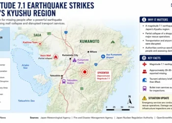
Editorial locator map showing the magnitude 7.1 earthquake in Japan's Kyushu region, including the epicenter, affected areas, infrastructure disruptions, and emergency response locations.

Japan Earthquake Triggers Mall Collapse as Rescuers Search for Dozens Missing

July 28, 2026
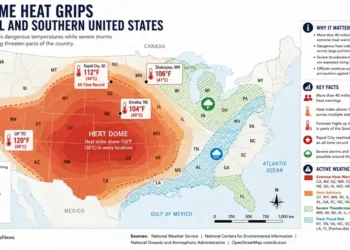
Map showing the extreme heat dome across the central and southern United States, highlighting heat warnings, severe storm risks, flash flood areas, and forecast temperatures.

Extreme Heat Grips Central and Southern U.S. as Millions Remain Under Weather Warnings

July 27, 2026
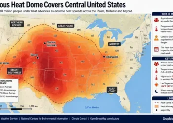
Map showing the dangerous heat dome covering the central United States, highlighting heat advisory areas, temperature anomalies, and affected regions.

Heat Dome Grips Central United States as Dangerous Temperatures Threaten Millions Through Next Week

July 26, 2026
Strong winds and rain from Typhoon Bavi affect eastern China after landfall. - Jiang Han/Xinhua via AP

Typhoon Bavi Weakens After China Landfall but Continues to Lash Eastern Regions

July 13, 2026
Storm clouds gather as Typhoon Bavi approaches China's eastern coastline.- AP Photo/Taijing Wu, File

Typhoon Bavi Nears China After Disrupting Taiwan as Deadly Week of Storms Continues

July 11, 2026
Wally Funk, pioneering pilot and the oldest woman to travel into space aboard Blue Origin. - AP Photo/Tony Gutierrez, File

Wally Funk, Trailblazing Aviator and Oldest Woman to Reach Space, Dies at 87

July 10, 2026
Person cooling off during an extreme heat wave without air conditioning - AP Photo/Adam Gray, File

How to Stay Safe During a Heat Wave Without Air Conditioning

July 2, 2026
Rescue workers search collapsed buildings after devastating earthquakes in Venezuela. - AP Photo/Matias Delacroix

Venezuela Earthquake Response Shifts Toward Long-Term Humanitarian Crisis as Rescue Window Narrows

June 29, 2026
Load More
JournosNews logo

Journos News delivers globally neutral, fact-based journalism that meets international media standards — clear, credible, and made for a connected world.

  • Categories
  • World News
  • Politics
  • Business & Markets
  • Technology
  • Health
  • Science
  • Sports
  • Arts & Culture
  • Resources
  • Editorial Standards
  • Submit a Story
  • Advertise with Us
  • Syndication & Partnerships
  • Site Map
  • Press & Media Kit
  • Editorial Team
  • Careers

Join thousands of readers receiving the latest updates, tips, and exclusive insights straight to their inbox. Never miss an important story again.

  • About Us
  • Editorial & Trust Center
  • Contact Us
  • Privacy Policy
  • Terms of Use & Copyright Notice

© JournosNews.com All rights reserved.

Welcome Back!

Login to your account below

Forgotten Password?

Retrieve your password

Please enter your username or email address to reset your password.

Log In
JournosNews

Independent Journalism.
Verified Facts.

You're about to read a professionally edited article from JournosNews.com.

Every article is produced in accordance with our editorial standards, emphasizing factual accuracy, transparent attribution, fairness, editorial independence, and meaningful context.

Editorial Standards
No Result
View All Result
  • Home
  • World
    • Africa
    • Americas
    • Asia
    • Europe
    • Middle East
    • Oceania
  • Politics
  • Business
  • Technology
  • Health
  • Science
  • Sports
  • Entertainment
  • Culture

© JournosNews.com All rights reserved.

This website uses cookies. By continuing to use this website you are giving consent to cookies being used. Visit our Privacy and Cookie Policy.