DUBAI, United Arab Emirates (Journos News) – A growing body of satellite imagery is beginning to map the geographic reach of the Iran war, revealing a pattern of strikes that extends beyond immediate battle zones into key military and logistical hubs across the Gulf. The emerging visual evidence suggests that the conflict is testing not only frontline capabilities but also the resilience of the broader regional security network.
According to a report by The Associated Press, newly released images from commercial providers offer one of the first verifiable glimpses into damage sustained on both Iranian territory and installations linked to U.S. and allied forces. The delayed release of high-resolution imagery underscores ongoing sensitivities around operational security, even as analysts begin to assess the scale of disruption.
The imagery, sourced from firms including Planet Labs, reflects a calibrated but widening exchange of strikes involving Iran, the United States, and Israel—one that is increasingly targeting infrastructure central to regional deterrence.

Strategic Maritime Nodes Come Under Pressure
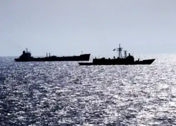
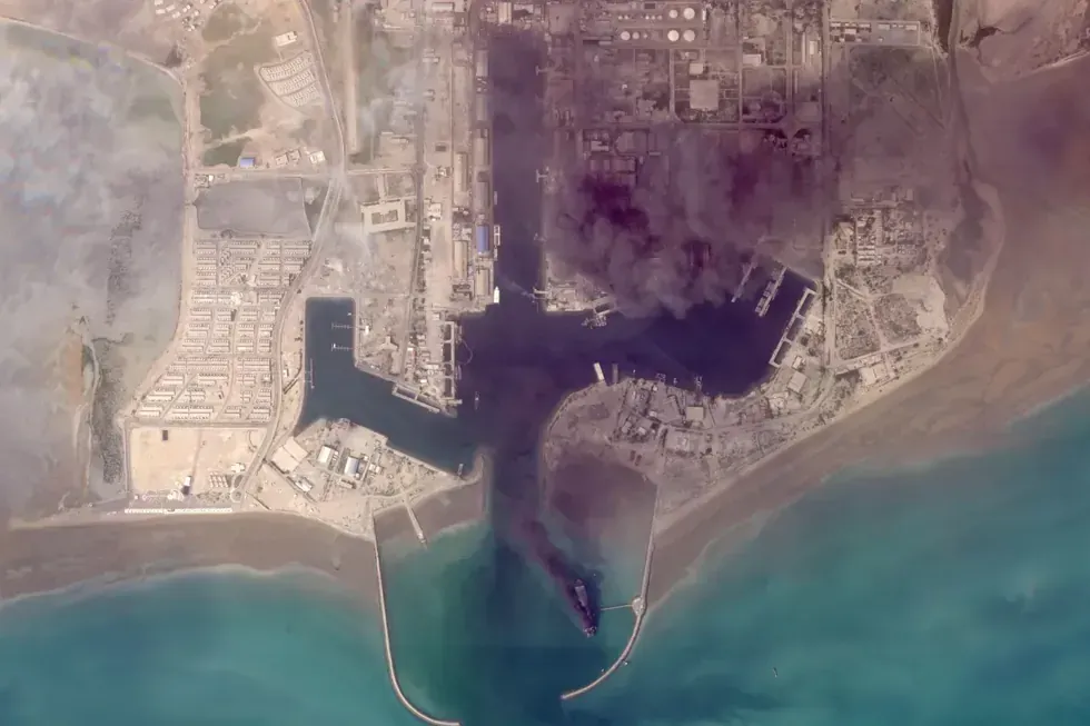
Satellite images captured in early March indicate fires aboard multiple vessels at Bandar Abbas, a critical Iranian port positioned along the Strait of Hormuz. The location serves as a central artery for Iran’s naval operations and a chokepoint for global energy transit.
The apparent targeting of maritime assets suggests an effort to constrain Iran’s naval maneuverability and disrupt its ability to project force in surrounding waters. U.S. Central Command has indicated that a significant number of Iranian vessels have been damaged or destroyed since the conflict began, though independent verification remains limited.
This evolving pressure on maritime infrastructure signals a shift toward restricting operational depth rather than solely degrading frontline capabilities.
Forward-Deployed Bases Absorb Direct Strikes
Beyond Iran’s borders, satellite imagery points to direct impacts on U.S. and allied installations. In Bahrain, where the U.S. Navy’s Fifth Fleet is headquartered, images show structural damage to key facilities, including radar-protected installations.
The targeting of such sites introduces new questions about the vulnerability of forward-deployed command infrastructure in the Gulf. While official assessments remain limited, visual indicators suggest that precision strikes are reaching deeper into established defense networks.
■ Related News




Iran has claimed responsibility for attacks on regional bases, while U.S. officials have yet to release a comprehensive damage assessment.
European Military Presence Drawn Into Strike Radius
Further west, imagery from Abu Dhabi reveals damage to infrastructure at a French naval installation, expanding the scope of affected actors beyond the immediate U.S.-Iran-Israel axis.
The inclusion of European-linked facilities within the strike pattern introduces an additional layer of geopolitical risk, potentially complicating alliance coordination and raising the stakes for broader international involvement.
The affected base, located near major commercial and cultural zones, highlights the proximity between military infrastructure and civilian economic centers in the Gulf.
Critical Infrastructure Exposure Raises Economic Risk
Separate satellite data has identified fires at major logistical and commercial sites, including an incident at Dubai International Airport involving a fuel tanker. Additional fires have been observed at a port facility in southern Oman.
These developments point to an emerging overlap between military targeting and economic infrastructure, increasing the potential for disruption to trade flows and energy distribution networks. While attribution remains contested in some cases, the pattern reflects a widening operational envelope.
The visibility of such incidents through satellite monitoring is also shaping public and market perceptions of risk, even as governments seek to control the narrative around damage assessments.
Regional Deterrence Framework Faces Sustained Testing
Taken together, the imagery outlines a conflict that is incrementally expanding in both scope and impact. Rather than a contained exchange, the pattern suggests sustained pressure across interconnected nodes of military and economic significance.
The delayed release of satellite data, while limiting real-time transparency, reinforces the extent to which information itself has become part of the strategic environment. As more imagery becomes available, the cumulative picture may further clarify how deeply the conflict is penetrating regional systems.
In the near term, the distribution of visible damage across multiple countries signals that the war’s footprint is no longer geographically confined—raising the prospect of prolonged strain on deterrence structures that have underpinned Gulf stability for decades.