When an experienced Italian mountaineer failed to return home in the autumn of 2024, rescuers in northern Italy were left with little more than a parked car and a fading mobile phone signal. Weeks of traditional search efforts across some of the Alps’ most unforgiving terrain produced no result.
Nearly a year later, after the snow retreated, the case took a decisive turn. Using drones and artificial intelligence to scan thousands of high-resolution images, mountain rescue teams were able to pinpoint a single anomaly on a vast rock face: a red helmet barely visible against the snow. It led them to the body of the missing climber and demonstrated how AI could reshape future search-and-rescue operations.
While the technology arrived too late to save a life in this case, rescuers and researchers say it offers a powerful new tool for finding missing people faster in remote environments where time often determines survival.
A disappearance in the Cottian Alps
Nicola Ivaldo, a 66-year-old orthopaedic surgeon and seasoned climber, set out alone on a Sunday in September 2024 in Italy’s Piemonte region. He did not tell friends or family where he planned to climb. When he failed to appear at work the following day, concerns were raised.
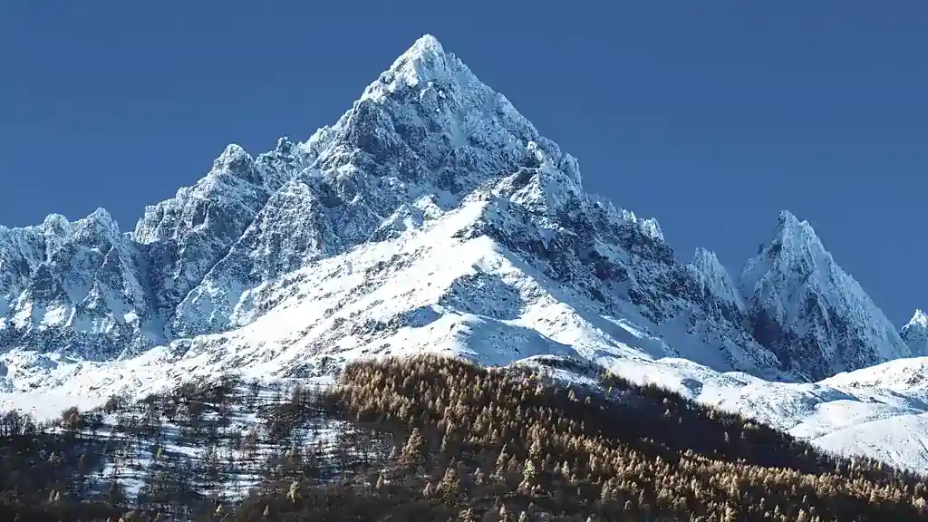
Rescuers soon located his car in the village of Castello di Pontechianale, in the Valle Varaita. From there, they believed Ivaldo had likely headed toward one of two prominent peaks in the Cottian Alps: Monviso, which rises to 3,841 metres, or the nearby Visolotto at 3,348 metres. His last known mobile phone signal placed him somewhere in that general area.
The information, however, left search teams with a daunting task. Both mountains are cut by steep rock walls, narrow gullies and multiple climbing routes, many far from popular paths. Hundreds of kilometres of trails criss-cross the surrounding terrain.
“The area is extremely complex,” said Simone Bobbio, a spokesperson for the Mountain and Speleological Rescue Service of Piemonte. “Each face has several possible lines of ascent, and visibility from the air is limited.”
A search halted by winter
More than 50 rescuers spent nearly a week searching on foot, supported by repeated helicopter flights. Conditions were initially favourable, and crowds had been present on the most popular routes the day Ivaldo disappeared. No one reported seeing him, leading rescuers to suspect he had chosen a more remote and technically demanding line.
By late September, early snowfall began to cover high-altitude gullies. With no new leads and worsening conditions, the operation was suspended. Any realistic hope of finding Ivaldo alive had faded.
The search resumed in July 2025, after much of the snow had melted from steep couloirs on Monviso’s northern face. This time, however, the rescue service added a new element: artificial intelligence.
Drones and algorithms in the mountains
Rescuers deployed two drones capable of flying close to rock walls and deep gullies that are difficult or dangerous for helicopters to access. Over five hours, the drones covered 183 hectares of mountainside, capturing more than 2,600 high-resolution images.
Instead of analysing each photograph manually, teams used AI software designed to scan aerial images pixel by pixel. The system searches for discontinuities in colour or texture — anything that appears out of place in a natural landscape.
“Until a few years ago, we would examine every single image ourselves,” said Saverio Isola, a drone pilot and chief of the mountain rescue station in Turin. “Now the analysis can be done in a matter of hours.”
The software flagged dozens of potential anomalies. Human expertise was then used to narrow the list, factoring in the terrain and the routes an experienced climber like Ivaldo might plausibly have taken.
A red helmet in the shade
From the AI-generated results, rescuers identified three priority locations. One image contained a small red object, partially shaded and barely visible against snow and rock.
When drones returned the following morning for closer inspection, the red shape proved to be Ivaldo’s helmet. His body was found nearby in a gully on the north wall of Monviso at an altitude of around 3,150 metres. It was recovered by helicopter three days after the renewed search began.
“The key was that red helmet identified by the software,” Bobbio said. “It detected the colour even though the helmet was in shadow.”
Without that single flagged image, rescuers believe the body might never have been found.
Promise and limits of AI-assisted rescue
The case is not the first to highlight the potential of AI in search operations. In 2021, software developed by a University of Wrocław spinoff in Poland helped locate a missing 65-year-old man in Beskid Niski in just over four hours, after analysing 782 aerial images. Two years later, the same algorithm was used to find another missing person in the Austrian Alps.
In the United Kingdom, similar technology has been used by mountain rescue teams to identify unusually coloured pixels in landscapes, aiding the recovery of a missing hillwalker in the Scottish Highlands in 2023.
Despite these successes, experts caution that the technology has clear limitations. Drones are far less effective in dense forests or poor visibility, and AI systems can generate false positives by misidentifying rocks, litter or natural colour variations.
“It can even hallucinate,” Isola said. “That’s why human judgment is still essential.”
Croatian mountain rescue officials, among the first in the European Union to adopt drones, have reported that complex karst landscapes and mixed vegetation can confuse existing algorithms.
Ethical and technical challenges ahead
Researchers say continued training of machine-learning models is critical. Tomasz Niedzielski, a geoinformatics expert at the University of Wrocław and leader of the SARUAV project, said open terrain with limited human presence remains the most suitable environment for automated detection.
“There is less chance of false positives in wide, open wilderness,” he said.
Others also raise ethical and legal concerns. Daniele Giordan, who leads the GeoHazard Monitoring Group at Italy’s Research Institute for Geo-Hydrological Protection, warned that analysing aerial images for human shapes carries responsibilities.
“Once you acquire aerial images, you have to consider how they are used,” he said. “Identifying people can raise legal issues.”
Giordan is working with researchers at Politecnico di Torino to develop more advanced systems that integrate drone data, team coordination and precise geo-referencing into a single platform. The long-term goal is to analyse images in real time during flights, allowing rescuers to react immediately.
A growing role in life-and-death searches
Other approaches are also emerging. Researchers at the University of Glasgow have developed models that simulate how lost people might move through landscapes, helping search teams prioritise likely locations even in forested terrain where drones are less effective.
For rescue services facing limited resources and extreme time pressure, such tools could become increasingly important. While no technology can eliminate the risks of the mountains, the ability to focus searches more quickly may mean the difference between recovery and rescue.
In the case of Nicola Ivaldo, AI arrived too late to save him. But for future climbers, walkers and rescue teams, a single coloured pixel spotted in time could one day mean survival.
This article was rewritten by JournosNews.com based on verified reporting from trusted sources. The content has been independently reviewed, fact-checked, and edited for accuracy, neutrality, tone, and global readability in accordance with Google News and AdSense standards.
All opinions, quotes, or statements from contributors, experts, or sourced organizations do not necessarily reflect the views of JournosNews.com. JournosNews.com maintains full editorial independence from any external funders, sponsors, or organizations.
Stay informed with JournosNews.com — your trusted source for verified global reporting and in-depth analysis. Follow us on Google News, BlueSky, and X for real-time updates.